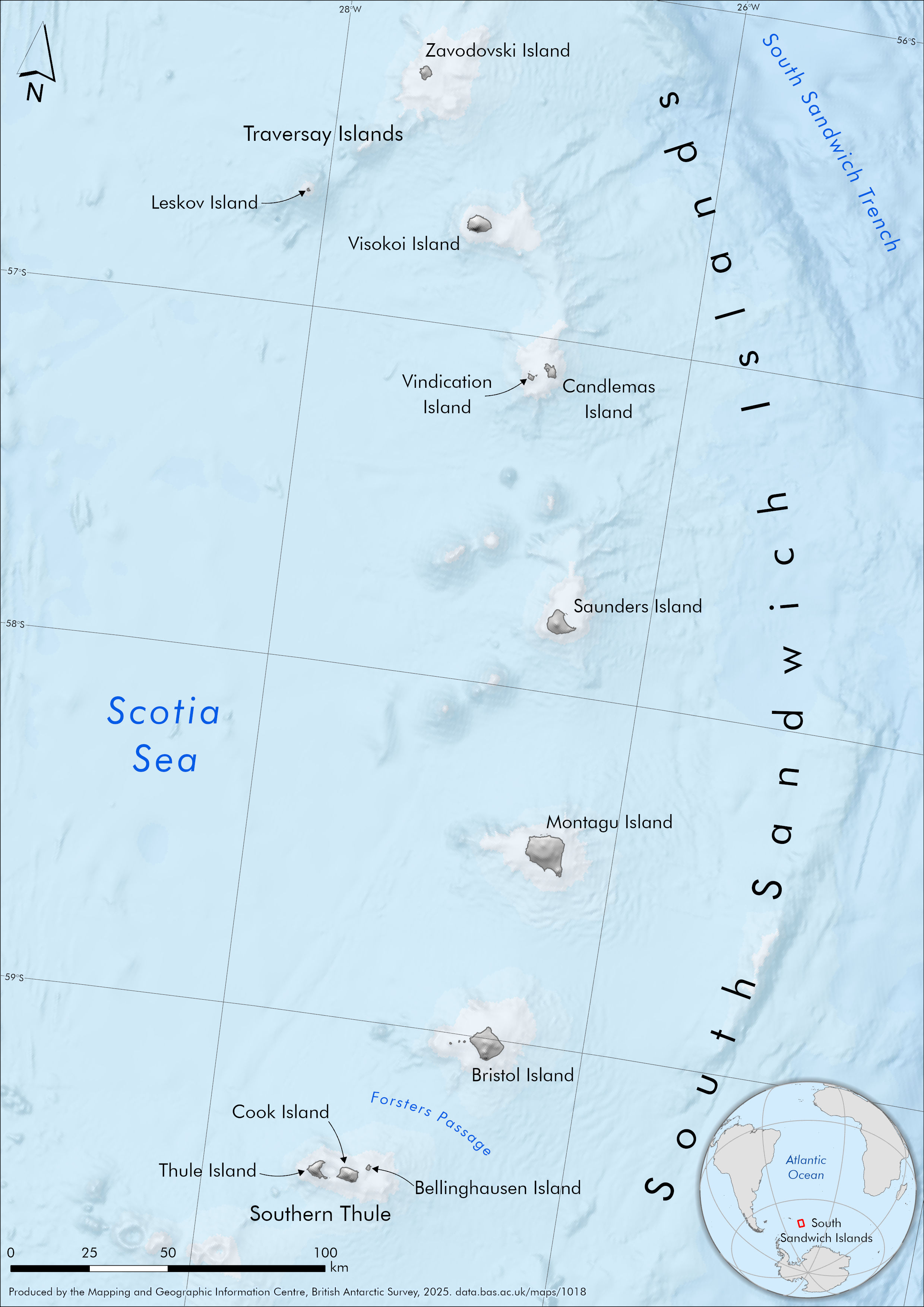
An A4 overview map of The South Sandwich Islands
- Collections
- Edition
- 1
- Published
Produced by the Mapping and Geographic Information Centre, British Antarctic Survey, 2026, version 1, https://data.bas.ac.uk/maps/1018.
An A4 map of the South Sandwich Islands. The map includes the 11 main islands and represents the land area with a standard greyscale hillshade. The surrounding sea floor is shown using GEBCO 2025 bathymetry data as a classified layer and also in relief using a hillshade. The Scotia Sea, South Sandwich Trench and Forsters Passage are also labelled. A small inset map is displayed in the corner, indicating The South Sandwich Islands location within the wider South Atlantic region.
Map Projection: WGS84 South Georgia Lambert, EPSG 3762. Central Meridian 37W
Data sources and references can be found in the lineage.