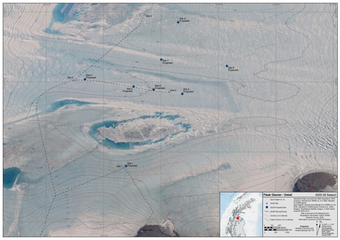
Field Map - Flask Glacier Overview
- Collections
- Edition
- 1
- Published
- Access
- Restricted
Produced by the Mapping and Geographic Information Centre, British Antarctic Survey, 2025, version 1, https://data.bas.ac.uk/maps/2057.
Map of Flask Glacier region 24/25 science season, showing planned study area and planned location of camp and instruments. Mapped over a Copernicus Sentinel-2 image acquired in January 2023. Contours are shown at 50 m interval and spot heights are shown in metres and feet. For use in operations planning during the 2025-26 operational season.
Projection: WGS84 Antarctic Polar Stereographic, central meridian 62.68° W. Vertical Datum: EGM08.
Data sources and references can be found in the lineage.