SCAR Air Operations Planning Maps
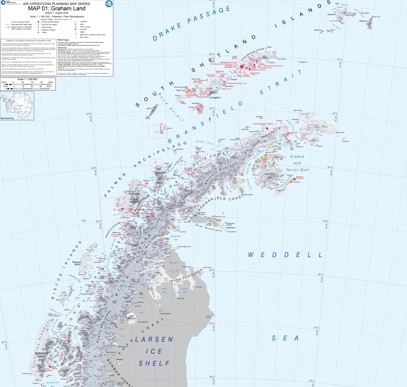
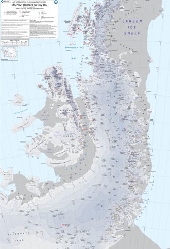
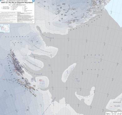
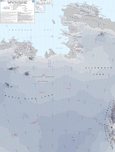
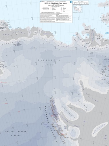
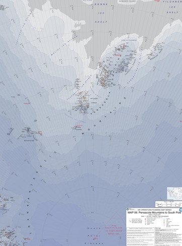
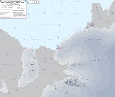
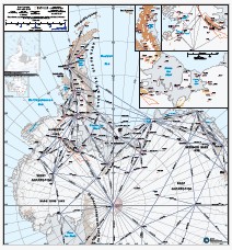
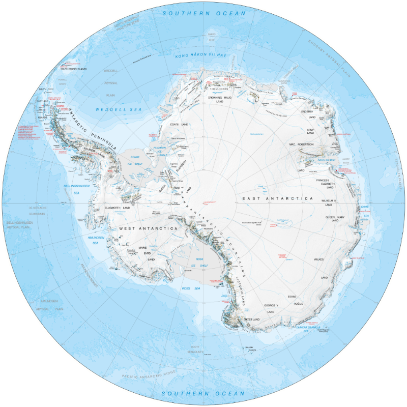
A collection of Sheets 1-7 of the SCAR Air Operations Planning Maps Series, produced by the Mapping and Geographic Information Centre, British Antarctic Survey.
These maps are updated at the beginning of every Antarctic season. New versions, as well as previous versions, will be added here over time.
All of these maps are available under an open licence.
For the remaining maps and for more information, please see https://scar.org/library-data/maps/air-operations-planning-maps.
Map of northern Antarctic Peninsula, Graham Land and Larsen Ice Shelf, for use in operations planning.
Map of Antarctic Peninsula, Graham Land to Palmer Land, for use in operations planning.
Map of Palmer Land and Ellsworth Land, for use in operations planning.
Map of Pine Island Bay area, for use in operations planning.
Map of Sky Blu to Pine Island Bay area, for use in operations planning.
Map of Pensacola Mountains to South Pole area, for use in operations planning.
Map of East Ronne Ice Shelf to Halley area, for use in operations planning.
Bounding Coordinates
- South-West Corner (min x/y)
- South: -90.0, West: -180.0
- North-East Corner (max x/y)
- North: -60.0, East: 180.0
Related to
A collection of maps produced for BAS Air Unit activities by the Mapping and Geographic Information Centre, British Antarctic Survey.
Part of these collections
A portfolio of maps produced by the Mapping and Geographic Information Centre, British Antarctic Survey.
Item Information
- Item ID
- 6793faf5-16c5-42dc-a835-b214db7f3e85
- Item Type
- COLLECTION
- Aliases
- Item created
- Item published
- Item updated
- Item released
- Item Status
- Item is a draft and should not yet be used
- Item Update Frequency
- Item may be updated if needed
Metadata Information
- Last updated
- Metadata Standard
- ISO 19115-2 Geographic Information - Metadata - Part 2: Extensions for Imagery and Gridded Data
- Metadata Standard Version
- ISO 19115-2:2009(E)
- Metadata Profiles
-
- British Antarctic Survey (BAS) Mapping and Geographic Information Centre (MAGIC) Discovery Metadata Profile (v2) External link, opens in a new window.
- British Antarctic Survey (BAS) Mapping and Geographic Information Centre (MAGIC) Administration Metadata Profile (v1) External link, opens in a new window.
- Metadata Licence
- Creative Commons Attribution-NoDerivatives 4.0 International External link, opens in a new window.
- Metadata Links
- Item page build time
Alternative contact methods
By post
British Antarctic SurveyHigh Cross
Madingley Road
Cambridge
Cambridgeshire
CB3 0ET
United Kingdom
By phone
By email
Privacy Notice
If you contact us, your personal information will be retained for up to three years and then deleted. It will only be used to contact you regarding your enquiry. If this item relates to an external organisation, we may share an anonymised version of your enquiry with them to help answer your query.
We use Cloudflare Turnstile, a third-party service, to protect against spam enquires.
See our privacy policy for more information.