BAS Published Maps
- Collections
- Edition
- 19
- Published
A collection of published, topographic and thematic maps produced by the Mapping and Geographic Information Centre, British Antarctic Survey. This collection does not contain all published maps, but more maps will be added here over the coming months and years. For further information, please see the BAS website.
Some maps are available under an open licence, others can be purchased from one of our suppliers, as detailed in each item.
All maps are available free of charge to BAS staff members. Please contact MAGIC to request a copy.
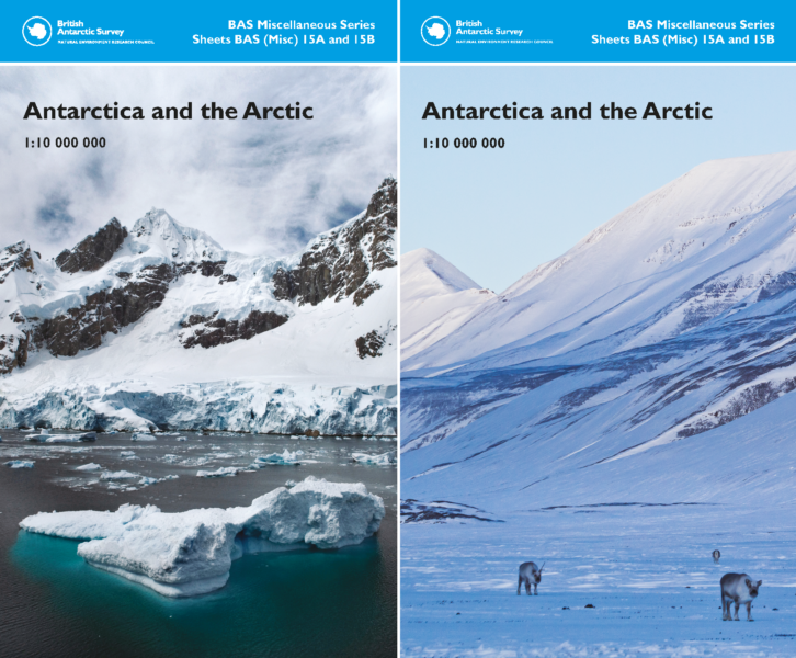
This double-sided topographic map covers Antarctica on one side and the Arctic on the reverse, at the same scale and with the same geographical extent.
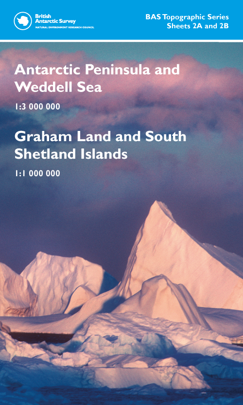
This double-sided map provides a regional overview of the Antarctic Peninsula and Weddell Sea area on side A with more detailed coverage of the northern Antarctic Peninsula region on side B.
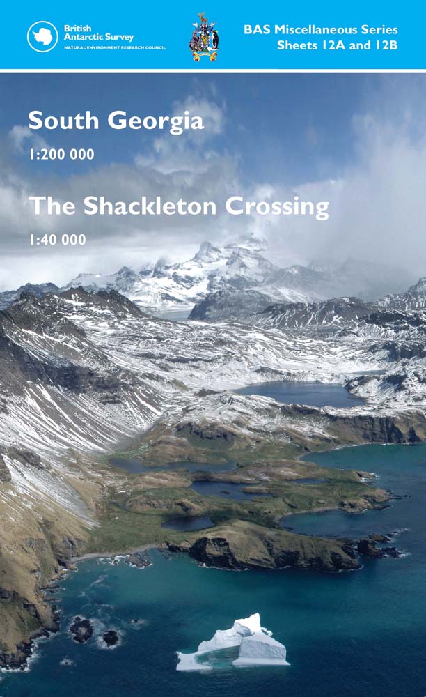
This double-sided map features South Georgia on one side and The Shackleton Crossing route on the reverse.
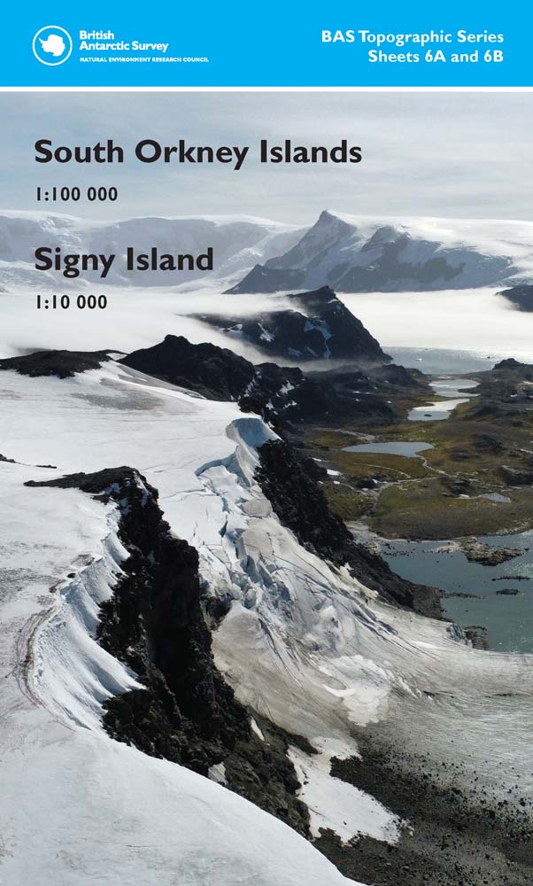
This double-sided topographic map covers the South Orkney Islands on one side and a more detailed map of Signy Island on the reverse.
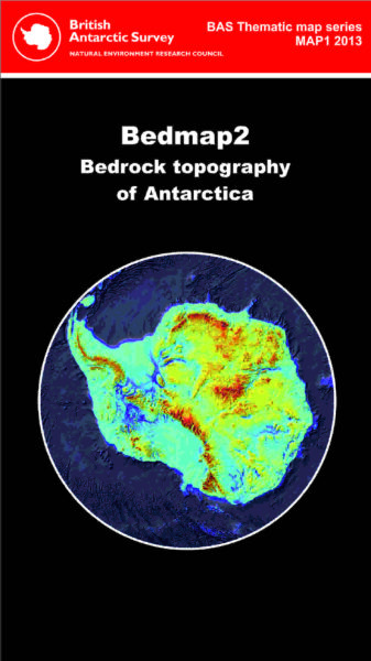
This map showcases Bedmap2. The geophysical and glaciological map shows the surface of the bed beneath the Antarctic Ice Sheet.
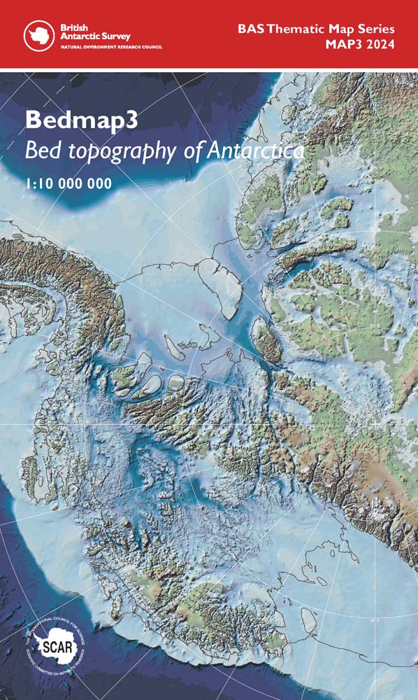
These maps showcase Bedmap3, the latest suite of gridded products describing the surface elevation, ice-thickness and the seafloor and subglacial bed elevation of Antarctica south of 60°S.
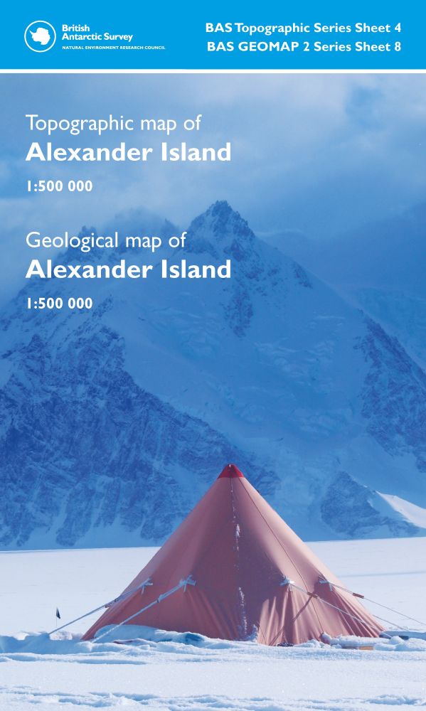
This double-sided map provides a topographic map on one side and a geological map on the other, both covering the same extent of Alexander Island and the surrounding islands.
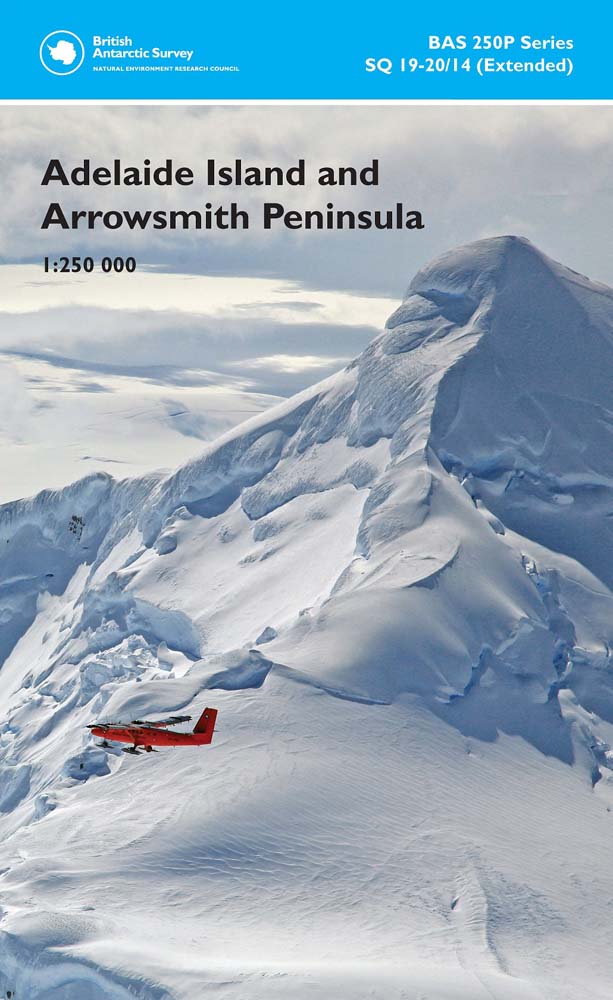
This double-sided map features both a topographic and a satellite image map, covering Adelaide Island and Arrowsmith Peninsula.
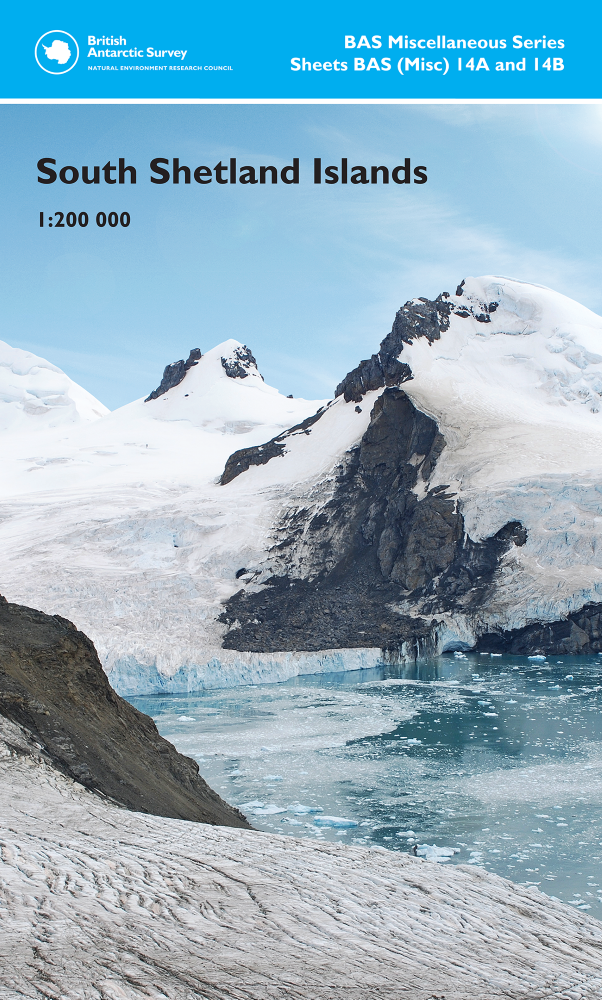
This double-sided map covers the South Shetlands Islands in three separate map panels, with a satellite image mosaic backdrop
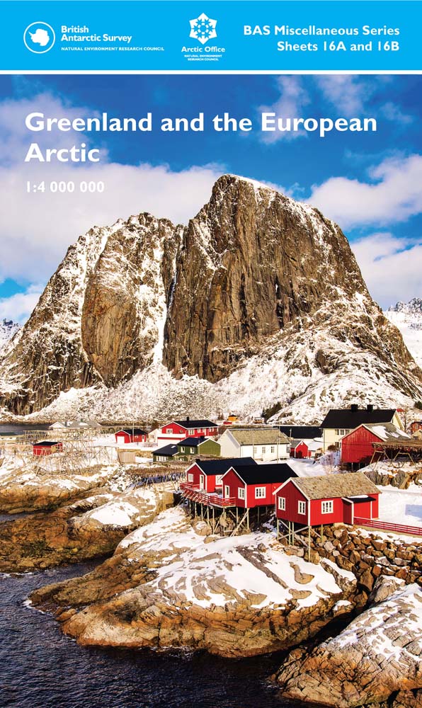
This double-sided sheet features a map of the Greenland and the European Arctic region on the front, with a vibrant information panel on the reverse covering a diverse range of topics around the Arctic.
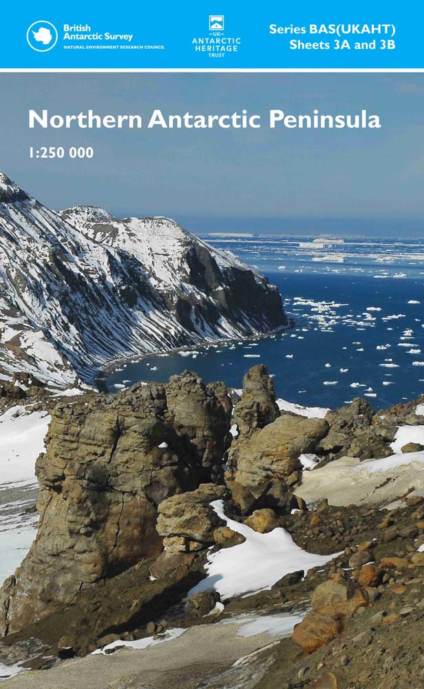
This double-sided map provides an overview of the northern part of the Antarctic Peninsula, showing topographic detail with a satellite image mosaic backdrop.
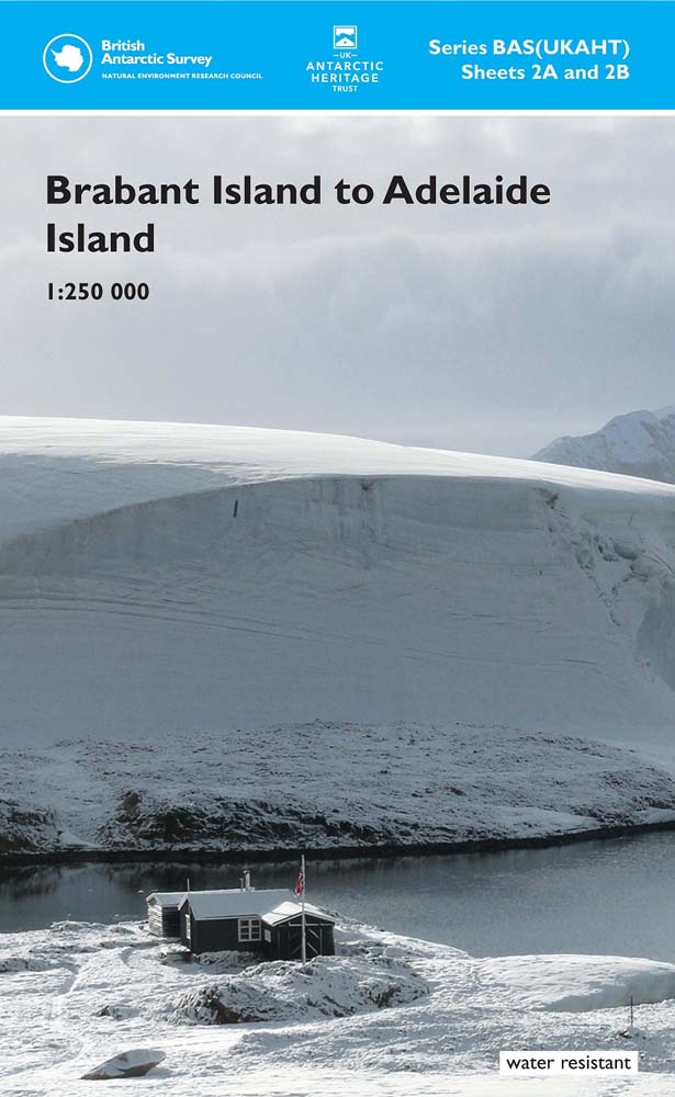
This double-sided map covers the area of the west coast of the Antarctic Peninsula between Brabant Island and Adelaide Island, showing topographic detail with a satellite image mosaic backdrop.
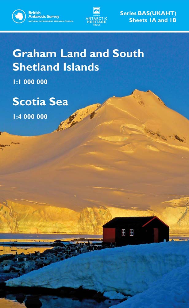
This double-sided map provides an overview of the northern Antarctic Peninsula area on side A, with a regional-scale map covering the Scotia Sea region on side B.
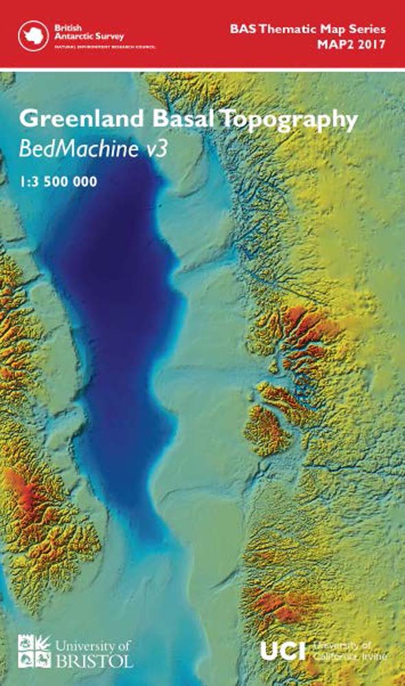
This double-sided geophysical and glaciological map shows the basal topography of Greenland and surrounding seabed.
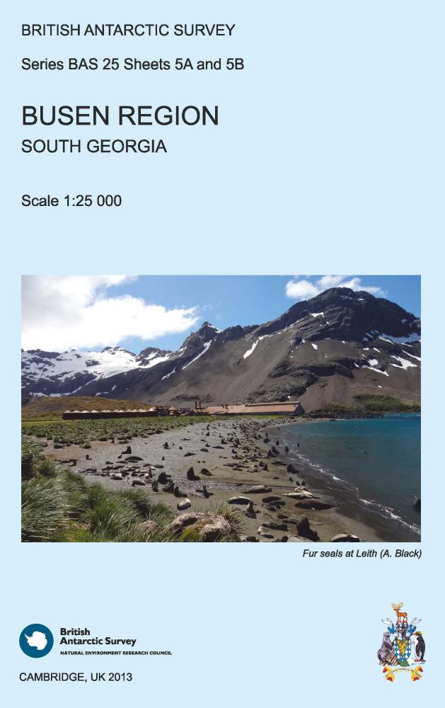
This double-sided map features a topographic map of the Busen Region, South Georgia on side A and local information and photos regarding a number of topics on the reverse.
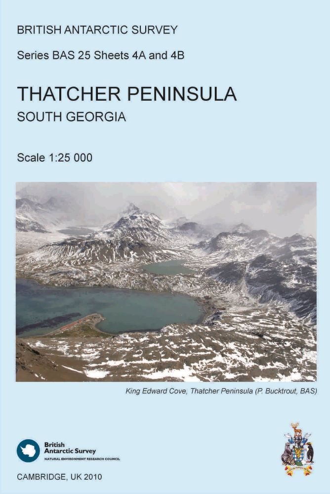
This double-sided map features both a topographic and a satellite image map of Thatcher Peninsula, South Georgia.
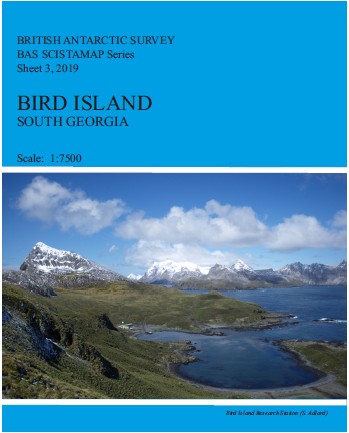
This 1:7500 scale map shows detailed topographic data of Bird Island.
Bounding Coordinates
- South-West Corner (min x/y)
- South: -90.0, West: -180.0
- North-East Corner (max x/y)
- North: 90.0, East: 180.0
Part of these collections
The Mapping and Geographic Information Centre (MAGIC) provides geospatial information, expertise and services to BAS and wider UK activity in the polar regions.
A portfolio of maps produced by the Mapping and Geographic Information Centre, British Antarctic Survey.
Item Information
- Item ID
- 6f5102ae-dfae-4d72-ad07-6ce4c85f5db8
- Item Type
- COLLECTION
- Item edition
- 19
- Item Created
- Item Published
- Item Updated
- Item Released
- Item Status
- Item is complete and recommended for general use
- Item Update Frequency
- Item may be updated if needed
Metadata Information
- Last updated
- Metadata Standard
- ISO 19115-2 Geographic Information - Metadata - Part 2: Extensions for Imagery and Gridded Data
- Metadata Standard Version
- ISO 19115-2:2009(E)
- Metadata Profiles
- British Antarctic Survey (BAS) Mapping and Geographic Information Centre (MAGIC) Discovery Metadata Profile (v2) External link, opens in a new window.
- British Antarctic Survey (BAS) Mapping and Geographic Information Centre (MAGIC) Administration Metadata Profile (v1) External link, opens in a new window.
- Metadata Licence
- Creative Commons Attribution-NoDerivatives 4.0 International External link, opens in a new window.
- Metadata Links
- Item page build time
Alternative contact methods
By post
British Antarctic SurveyHigh Cross
Madingley Road
Cambridge
Cambridgeshire
CB3 0ET
United Kingdom
By phone
By email
Privacy Notice
If you contact us, your personal information will be retained for up to three years and then deleted. It will only be used to contact you regarding your enquiry. If this item relates to an external organisation, we may share an anonymised version of your enquiry with them to help answer your query.
We use Cloudflare Turnstile, a third-party service, to protect against spam enquires.
See our privacy policy for more information.