BAS General Interest Maps
- Collections
- Edition
- 22
- Published
An overview collection of general interest maps produced by the Mapping and Geographic Information Centre, British Antarctic Survey. These maps cover a wide range of topics and are available to download as JPEG, PNG or PDF.
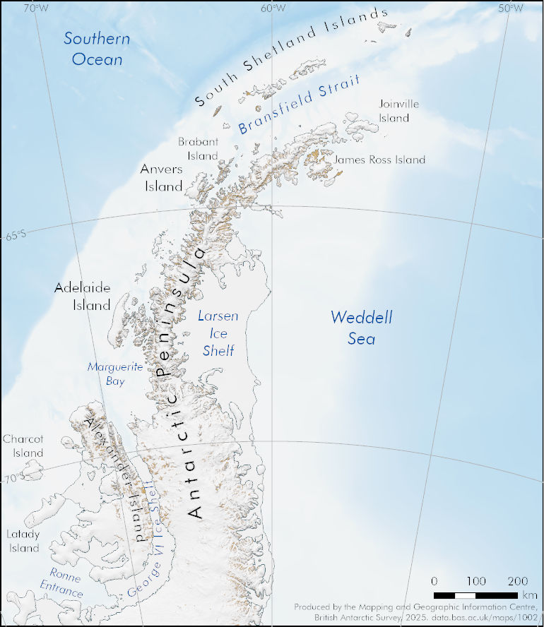
A small overview map of the Antarctic Peninsula region, including the South Shetland Islands and South Orkney Islands.
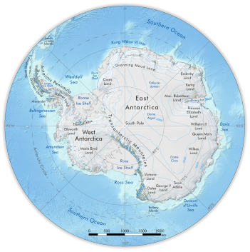
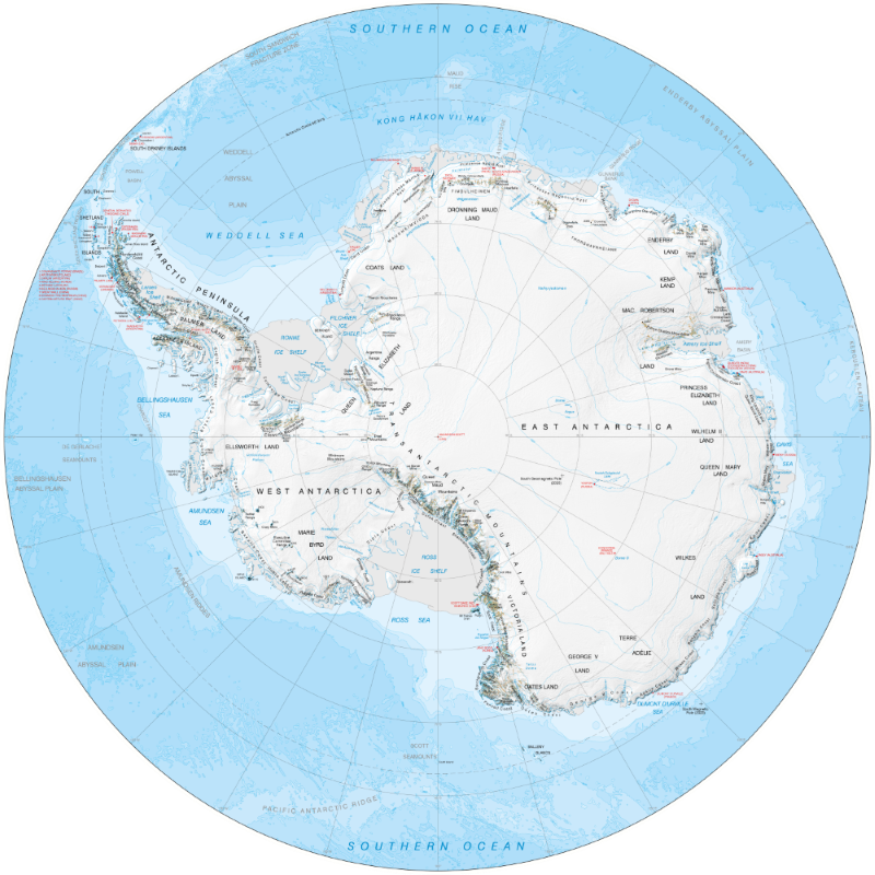
A general overview map of Antarctica south of 60°S.
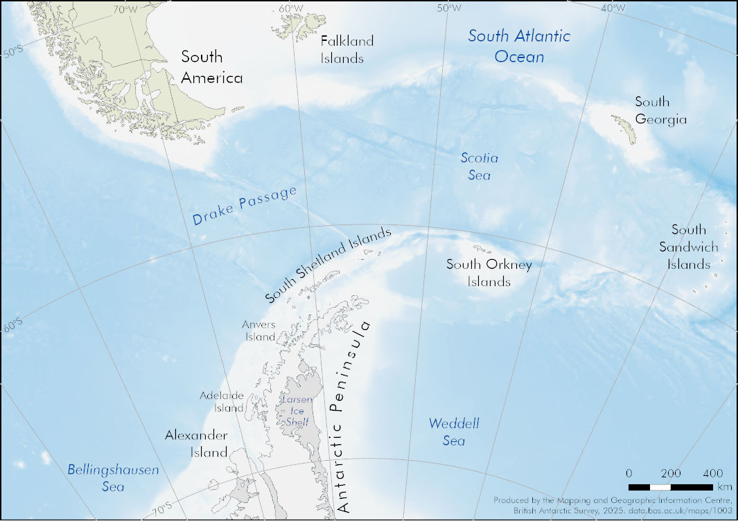
A small overview map of the Scotia Sea region.
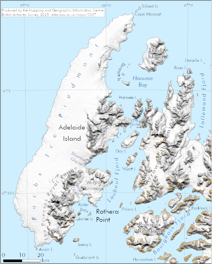
A small map covering Adelaide Island and Arrowsmith Peninsula, on the western side of the Antarctic Peninsula.
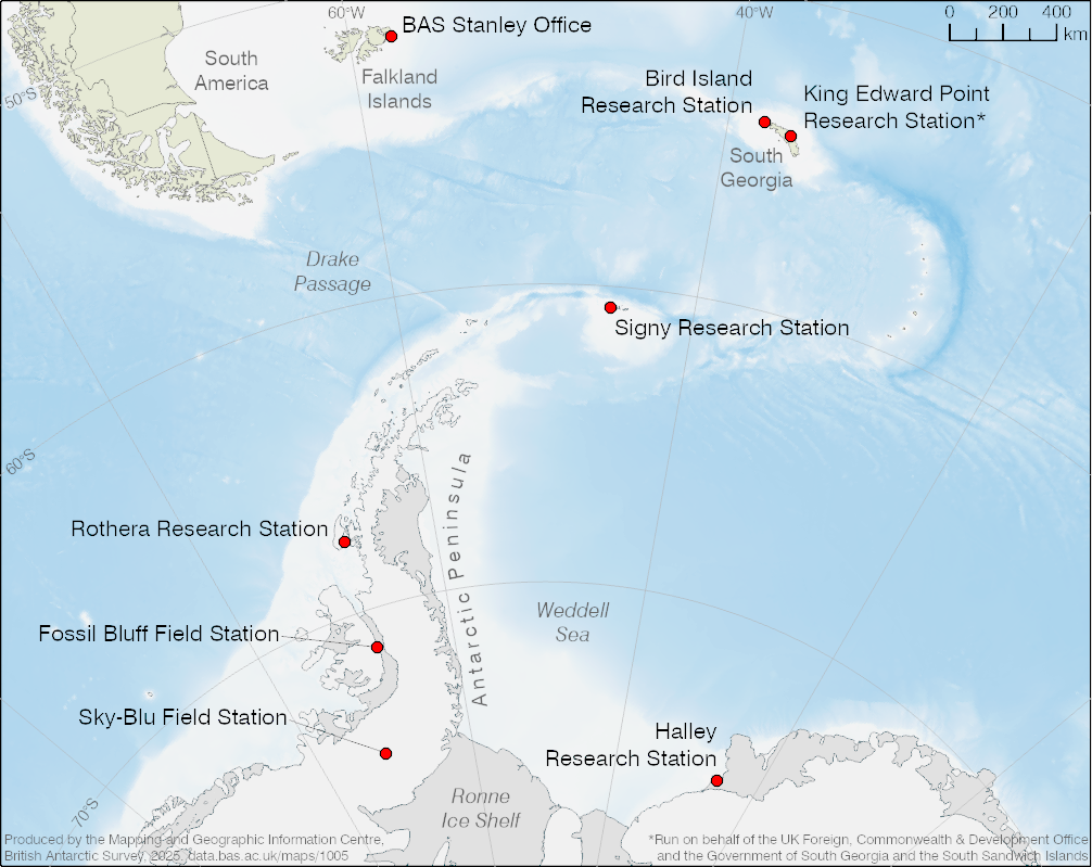
A map showing British Antarctic Survey stations in Antarctica and the South Atlantic region.
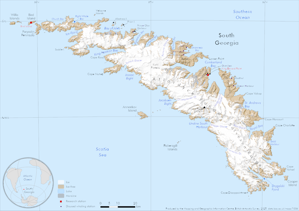
An A4 map of the island of South Georgia in the Southern Ocean, showing research stations and disused whaling stations.
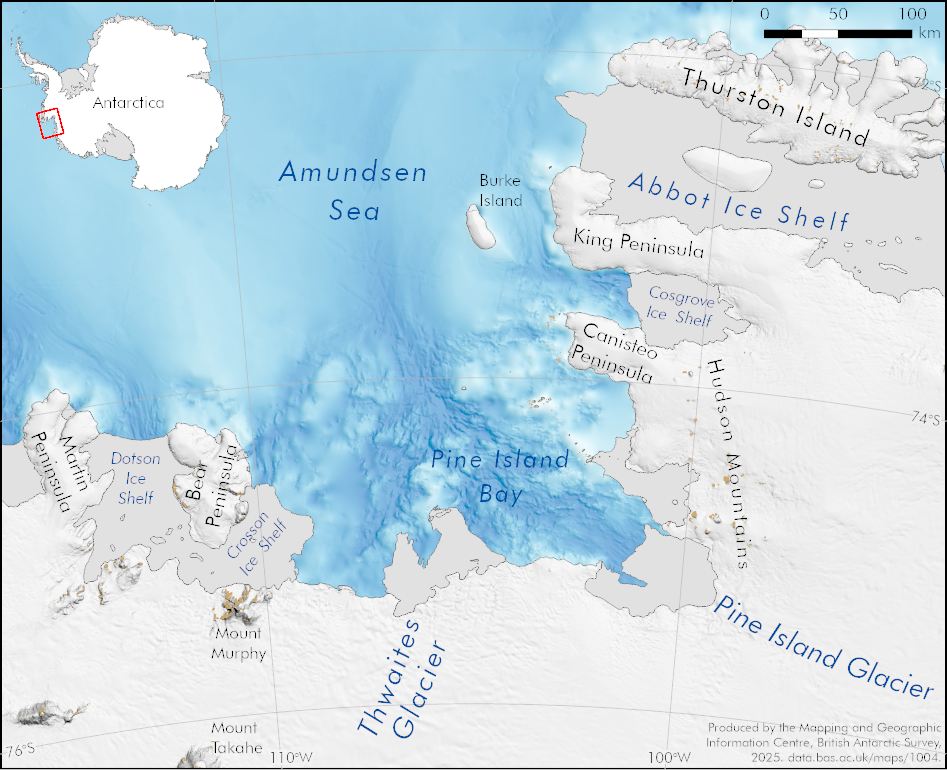
A map covering a section of the Amundsen Sea region, including Thwaites and Pine Island glaciers flowing into Pine Island Bay.
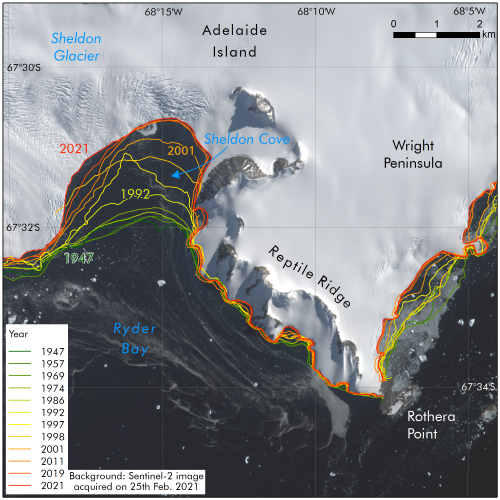
A map showing the retreat of Sheldon Glacier between 1947 and 2021.
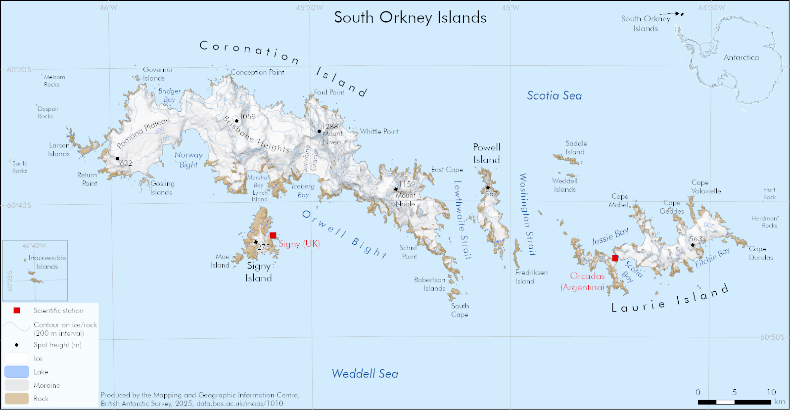
A map of the South Orkney Islands with a hillshade, contours and land cover.
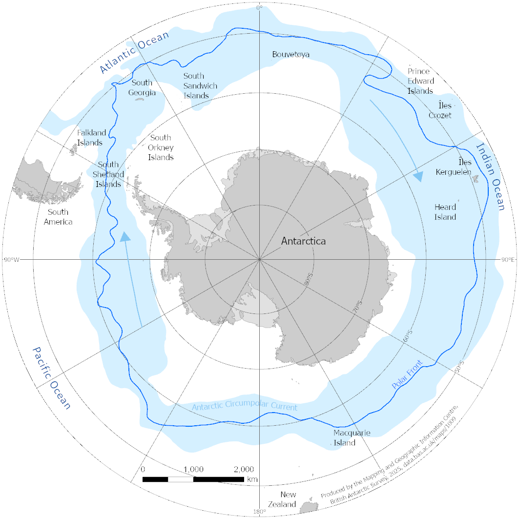
A map of sub-Antarctic islands and the Antarctic Circumpolar Current.
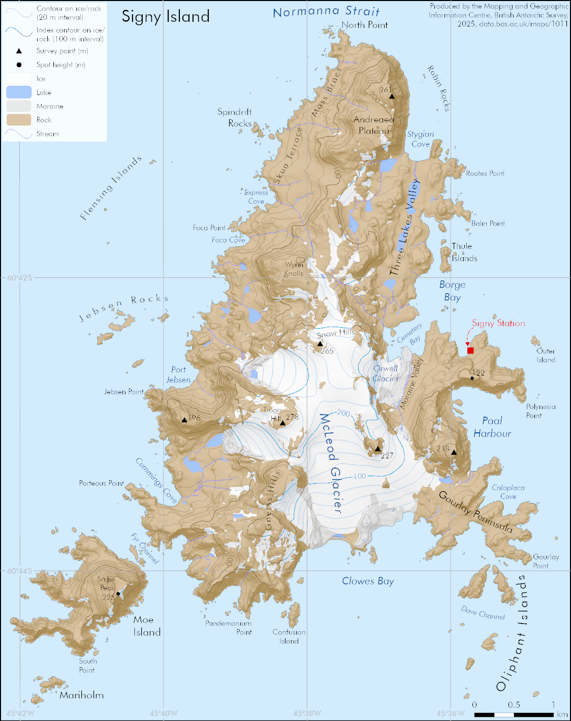
A map of Signy Island with a hillshade, contours and land cover.
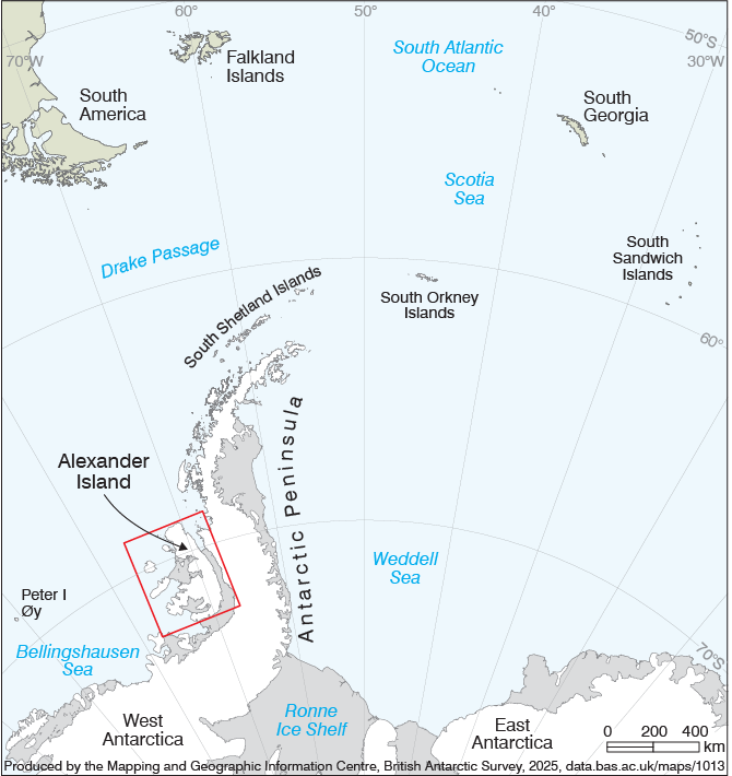
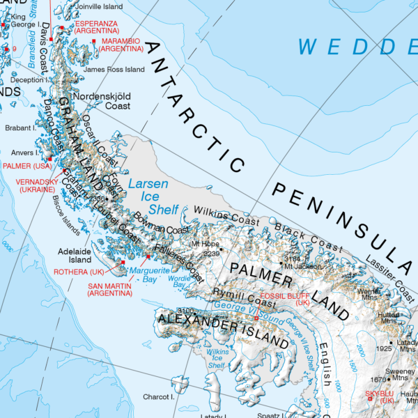
A small map indicating the location of Alexander Island within the wider Antarctica/South America region.
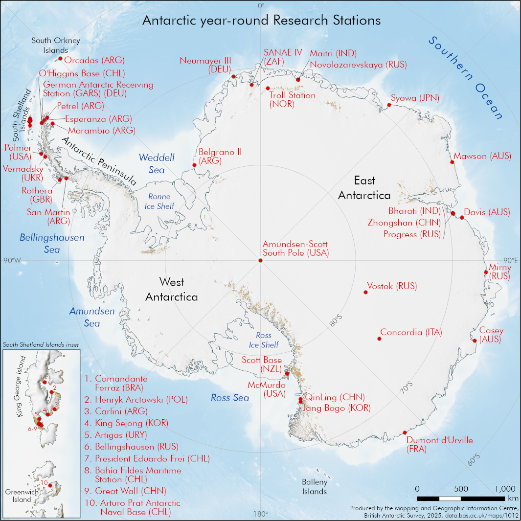
A map of Antarctica showing year-round research stations.
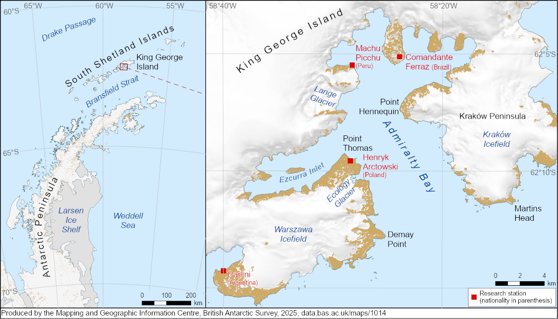
A 2 panel map, highlighting the location of Ecology Glacier and Admiralty Bay on King George Island, South Shetland Islands
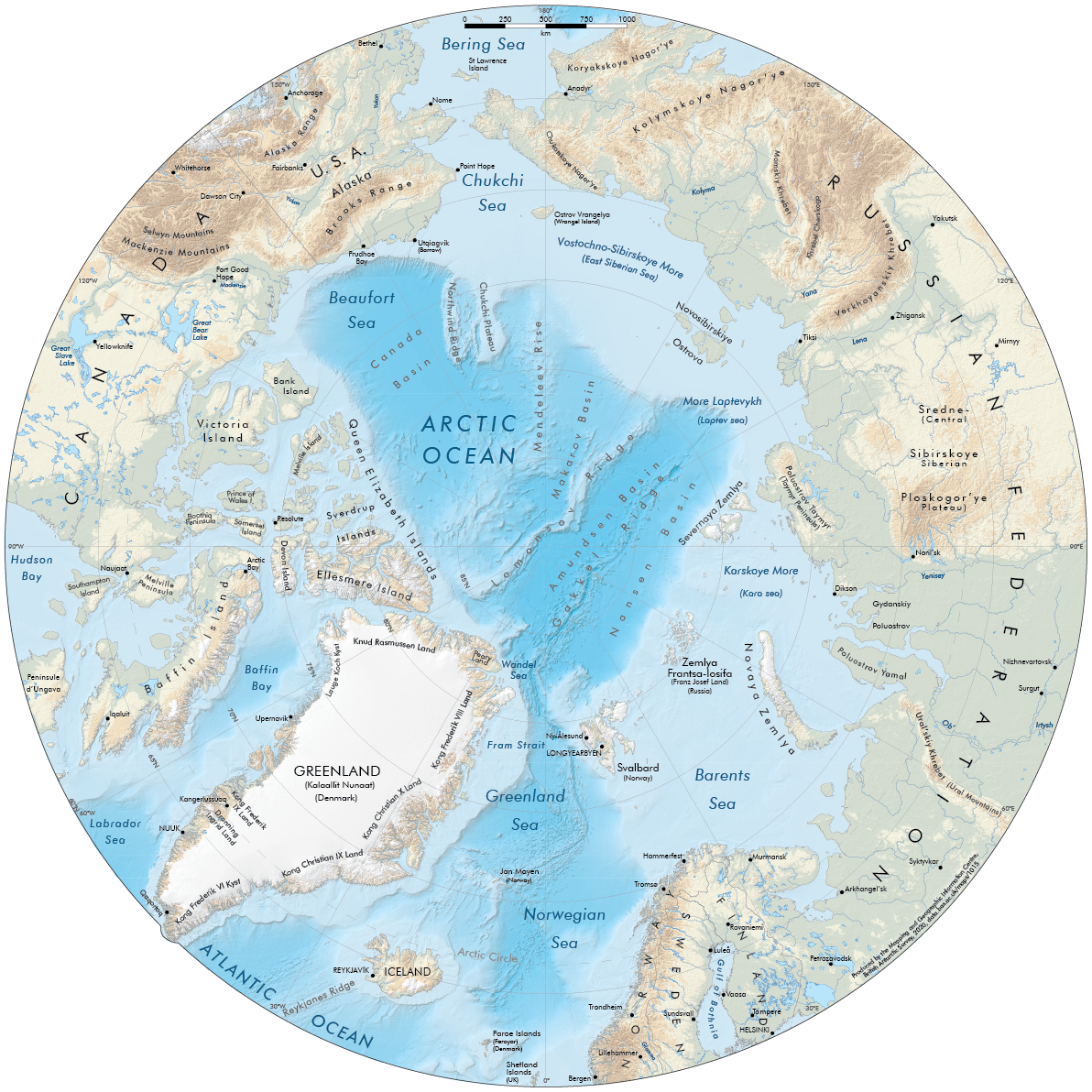
A 1:16 000 000 scale map covering the Arctic north of 60°N, with shaded relief, rivers, lakes and towns.
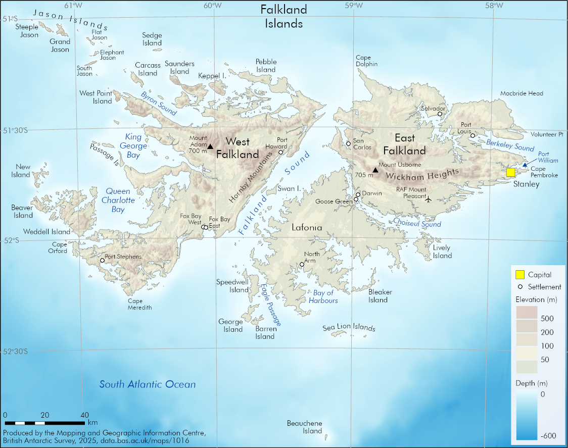
An overview map of the Falkland Islands, showing key place names, settlements and elevation.
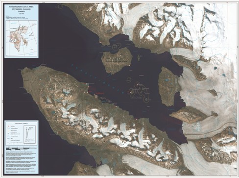
Map of Kongsfjorden local area, showing locations of huts, tracks and nature reserves as of June 2023, mapped over a satellite image from August 2025.
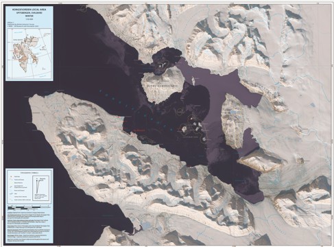
Map of Kongsfjorden local area, showing locations of huts, tracks and nature reserves as of June 2023, mapped over a satellite image from May 2025.

A 2 panel figure displaying sea ice extents around Antarctica and the Arctic, comparing a 30-year baseline average with a more recent 10-year average.
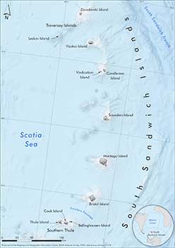
An A4 map of the 11 South Sandwich Islands and surrounding seas.
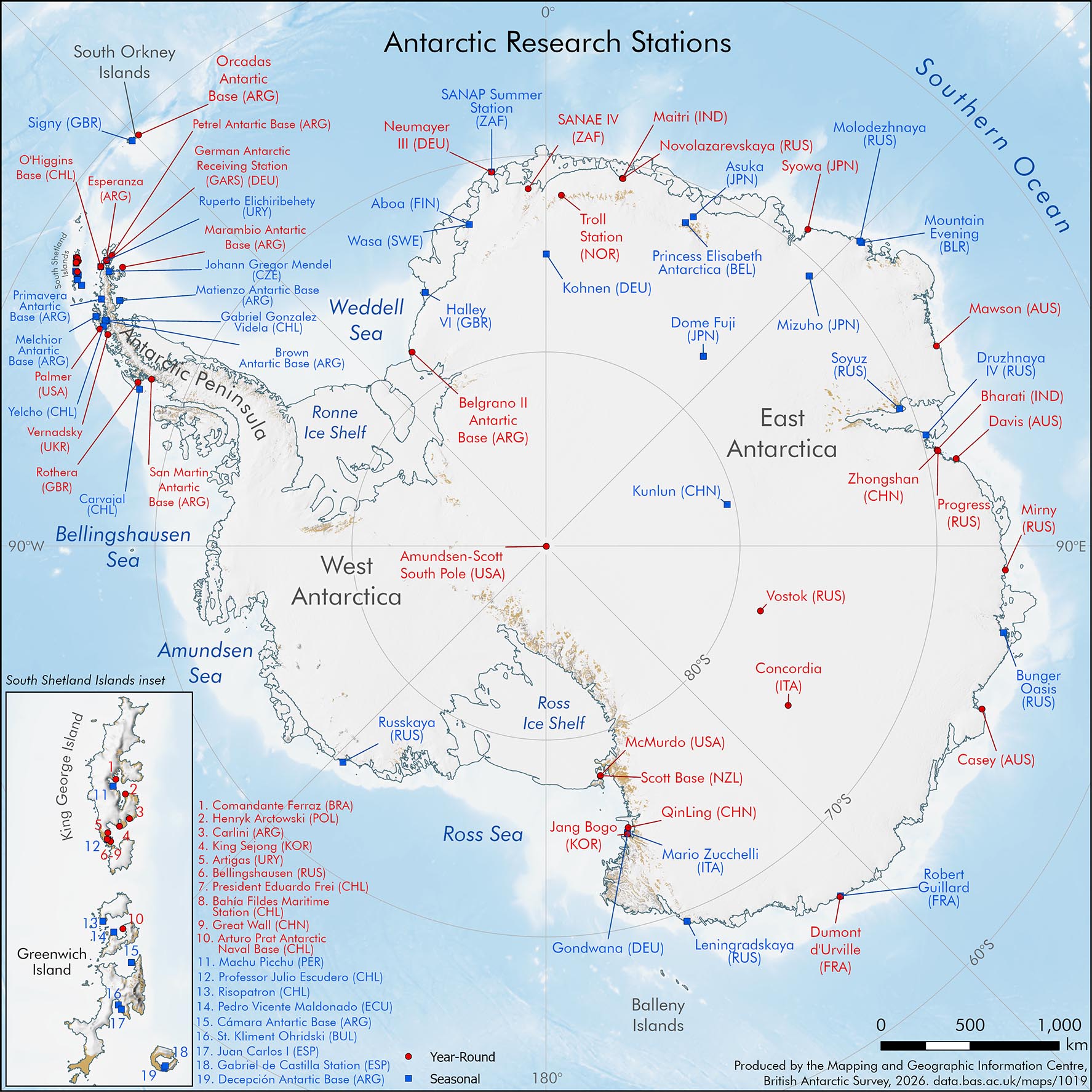
A map of Antarctica showing year-round and seasonal Research Stations.
Bounding Coordinates
- South-West Corner (min x/y)
- South: -90.0, West: -180.0
- North-East Corner (max x/y)
- North: 90.0, East: 180.0
Part of these collections
The Mapping and Geographic Information Centre (MAGIC) provides geospatial information, expertise and services to BAS and wider UK activity in the polar regions.
A portfolio of maps produced by the Mapping and Geographic Information Centre, British Antarctic Survey.
Item Information
- Item ID
- d0d91e22-18c1-4c7f-8dfc-20e94cd2c107
- Item Type
- COLLECTION
- Item edition
- 22
- Item Created
- Item Published
- Item Updated
- Item Released
- Item Status
- Item is complete and recommended for general use
- Item Update Frequency
- Item may be updated if needed
Metadata Information
- Last updated
- Metadata Standard
- ISO 19115-2 Geographic Information - Metadata - Part 2: Extensions for Imagery and Gridded Data
- Metadata Standard Version
- ISO 19115-2:2009(E)
- Metadata Profiles
- British Antarctic Survey (BAS) Mapping and Geographic Information Centre (MAGIC) Discovery Metadata Profile (v2) External link, opens in a new window.
- British Antarctic Survey (BAS) Mapping and Geographic Information Centre (MAGIC) Administration Metadata Profile (v1) External link, opens in a new window.
- Metadata Licence
- Creative Commons Attribution-NoDerivatives 4.0 International External link, opens in a new window.
- Metadata Links
- Item page build time
Alternative contact methods
By post
British Antarctic SurveyHigh Cross
Madingley Road
Cambridge
Cambridgeshire
CB3 0ET
United Kingdom
By phone
By email
Privacy Notice
If you contact us, your personal information will be retained for up to three years and then deleted. It will only be used to contact you regarding your enquiry. If this item relates to an external organisation, we may share an anonymised version of your enquiry with them to help answer your query.
We use Cloudflare Turnstile, a third-party service, to protect against spam enquires.
See our privacy policy for more information.