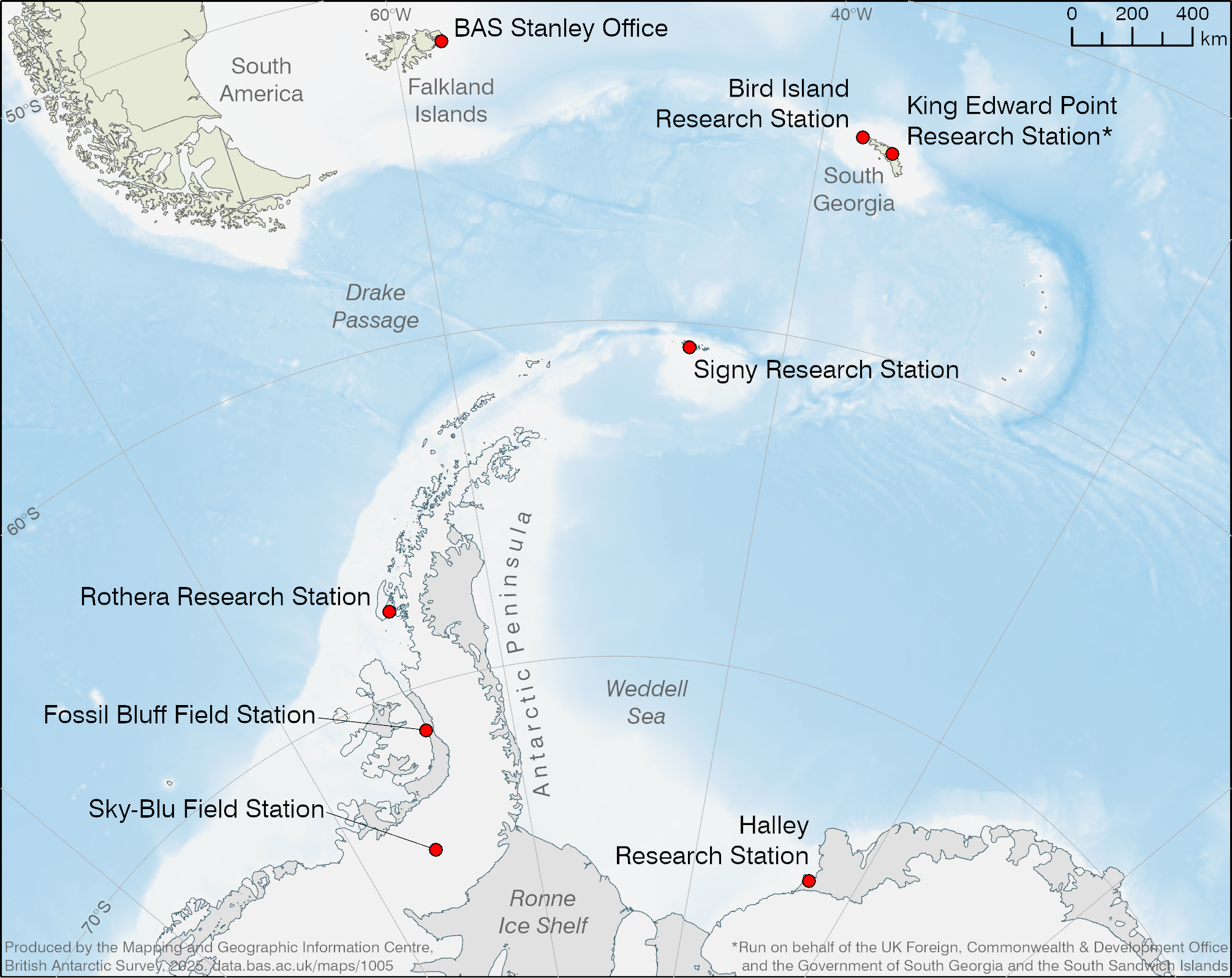
A map of British Antarctic Survey stations in Antarctica and the South Atlantic
- Collections
- Edition
- 1
- Published
Produced by the Mapping and Geographic Information Centre, British Antarctic Survey, 2025, version 1, https://data.bas.ac.uk/maps/1005.
A map showing British Antarctic Survey stations in Antarctica and the South Atlantic region. The map covers a region including the Falkland Islands, South Georgia, the South Sandwich Islands, the Antarctic Peninsula and western Dronning Maud Land. Bathymetry is indicated with a blue colour ramp, and selected place names are shown.
Map projection: WGS84 Antarctic Polar Stereographic: Central Meridian 50°W, Standard Parallel 65°S
Data sources and references can be found in the lineage.