SCAR Antarctic Digital Database (ADD)
- Edition
- 21
- Published
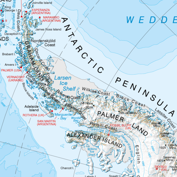
The Scientific Committee on Antarctic Research (SCAR) Antarctic Digital Database (ADD) aims to provide seamless topographic datasets compiled from the best available geographic information. It covers Antarctica south of 60°S.
The SCAR ADD consists of the following datasets, available to download from this catalogue:
- coastline, including grounding lines and ice shelf fronts
- rock outcrop
- contours
- lakes
- moraine
- streams
- seamask
- ADD data limit at 60°S
The ADD is managed by British Antarctic Survey, see the website for more information on the project.
Previous versions of ADD datasets can be found here. Not all previous versions are currently available but we are working to include more soon.
The ADD map viewer also displays supplemental datasets to provide context to the ADD datasets. You can download these here.

Antarctic coastline south of 60°S, consisting of ice coastline, rock coastline, grounding line, ice shelf and front, ice rumple, and 'rock against ice shelf' line features.
Generalised Antarctic coastline south of 60°S, consisting of ice coastline, rock coastline, grounding line, ice shelf and front, ice rumple, and 'rock against ice shelf' line features.
Antarctic coastline south of 60°S, consisting of land, ice shelf, ice tongue, and rumple features as polygons.
Generalised Antarctic coastline south of 60°S, consisting of land, ice shelf, ice tongue and rumple features as polygons.
Continuous 100m interval contours for land south of 60°S, generated from REMA v1.1 and other sources.
Continuous, smoothed 500m interval contours for land south of 60°S, generated from REMA v1.1 and other sources.
Rock outcrop in Antarctica, automatically extracted from Landsat 8 imagery.
Rock outcrop in Antarctica derived from maps and remote sensing data from 1960-2025. Primarily compiled in 1993 with uncertain quality and accuracy.
Generalised rock outcrop in Antarctica derived from maps and remote sensing data from 1960-2025. Primarily compiled in 1993 with uncertain quality and accuracy.
Moraine features in Antarctica derived from maps and remote sensing data. Incomplete.
Generalised moraine features in Antarctica derived from maps and remote sensing data. Incomplete.
Surface lake features in Antarctica derived from maps and remote sensing data. Significantly incomplete.
Generalised surface lake features in Antarctica derived from maps and remote sensing data. Significantly incomplete.
Stream features in Antarctica mainly covering Byers Peninsula, Deception Island, James Ross and Seymour islands, Fossil Bluff and parts of the Transantarctic Mountains. Significantly incomplete.
A high resolution seamask for regions south of 60°S, comprised of a roundel polygon with all land and ice shelves erased.
A medium resolution seamask for regions south of 60°S, comprised of a roundel polygon with all land and ice shelves erased.
A vector polyline at 60°S which is the northern limit for ADD datasets.
Bounding Coordinates
- South-West Corner (min x/y)
- South: -90.0, West: -180.0
- North-East Corner (max x/y)
- North: -60.0, East: 180.0
Related collections
The Mapping and Geographic Information Centre (MAGIC) provides geospatial information, expertise and services to BAS and wider UK activity in the polar regions.
Previous versions of Scientific Committee on Antarctic Research (SCAR) Antarctic Digital Database (ADD) datasets.
Additional datasets used to provide context in the Antarctic Digital Database map viewer.
Item Information
- Item ID
- e74543c0-4c4e-4b41-aa33-5bb2f67df389
- Item Type
- COLLECTION
- Item edition
- 21
- Item Created
- Item Published
- Item Updated
- Item Released
- Item Status
- Item is complete and recommended for general use
- Item Update Frequency
- Item is updated twice a year
Metadata Information
- Last updated
- Metadata Standard
- ISO 19115-2 Geographic Information - Metadata - Part 2: Extensions for Imagery and Gridded Data
- Metadata Standard Version
- ISO 19115-2:2009(E)
- Metadata Profiles
- British Antarctic Survey (BAS) Mapping and Geographic Information Centre (MAGIC) Discovery Metadata Profile (v2) External link, opens in a new window.
- British Antarctic Survey (BAS) Mapping and Geographic Information Centre (MAGIC) Administration Metadata Profile (v1) External link, opens in a new window.
- Metadata Licence
- Creative Commons Attribution-NoDerivatives 4.0 International External link, opens in a new window.
- Metadata Links
- Item page build time
Alternative contact methods
By post
British Antarctic SurveyHigh Cross
Madingley Road
Cambridge
Cambridgeshire
CB3 0ET
United Kingdom
By phone
By email
Privacy Notice
If you contact us, your personal information will be retained for up to three years and then deleted. It will only be used to contact you regarding your enquiry. If this item relates to an external organisation, we may share an anonymised version of your enquiry with them to help answer your query.
We use Cloudflare Turnstile, a third-party service, to protect against spam enquires.
See our privacy policy for more information.