BAS Operations Maps
- Collections
- Edition
- 24
- Published
A collection of maps produced for BAS Operations activities by the Mapping and Geographic Information Centre, British Antarctic Survey.
Most of these maps are restricted to specific groups of BAS staff members, others are under an open licence, as detailed in each item. For BAS staff members, select 'Download' to request permission for access on each item.
The collection does not yet contain all Operational maps, but more will be added over the coming months and years.
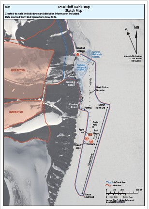
Site map of Fossil Bluff field camp produced for Standard Operating Procedure (SOP) documentation, showing locations of sites of interest, flagline, skiway, and travel areas.
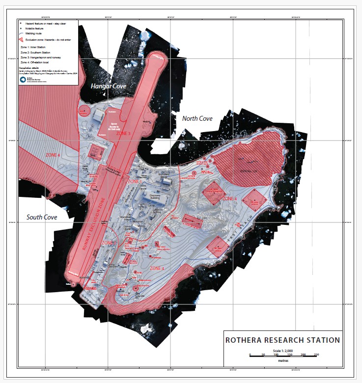
Site map of Rothera Research Station, showing locations of hazards, instruments, buildings, and access and exclusion zones.
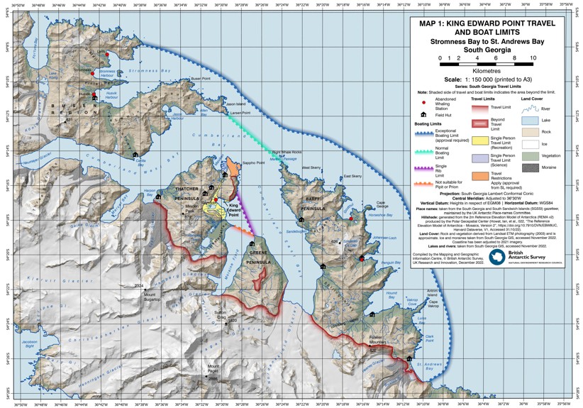
Map of South Georgia between Fortuna Bay and St Andrews Bay. Includes locations of field huts, boating limits, and overland travel limits.
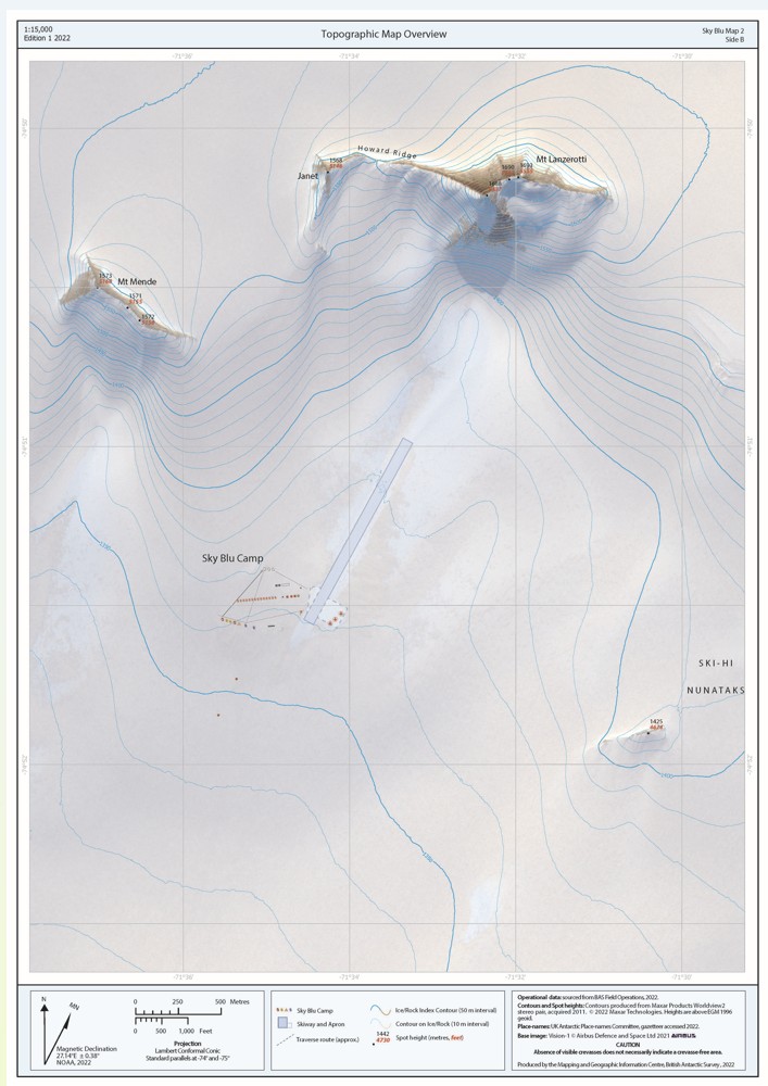
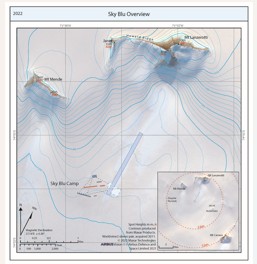
Topographic map of Sky Blu local area with satellite imagery, showing contours, spot heights, the field camp layout, locations of sites of interest and the runway.

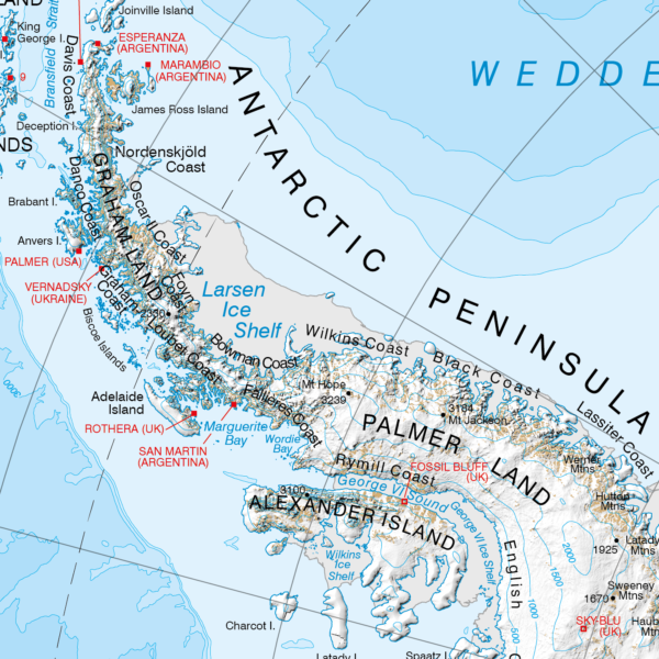
Topographic Map of the Ryder Bay region including bathymetry and boating limits for Rothera Operations.
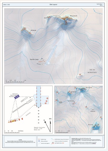
Topographic map of Sky Blu in three panels, showing the field camp layout, local, and regional topography. Includes contours and spot heights, locations of sites of interest and the runway.
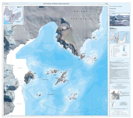
Topographic Map of the Ryder Bay region, including Rothera Research Station. Includes satellite imagery, contours, spot heights, and operational data.
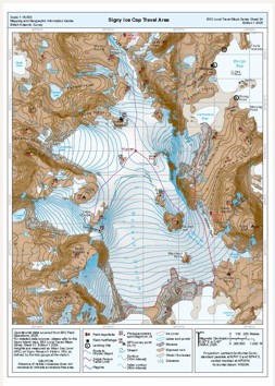
Topographic Map of Signy Island, showing contours, spot heights, locations of huts, routes and ice cap travel area.
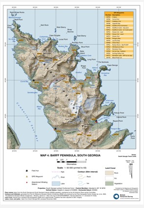
Map of Barff Peninsula, South Georgia. Includes contours, spot heights, land cover information and locations of paths, field huts and GPS waypoints.
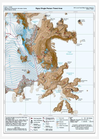
Topographic Map of Signy Island, showing contours, spot heights, locations of huts, routes and single person travel area.
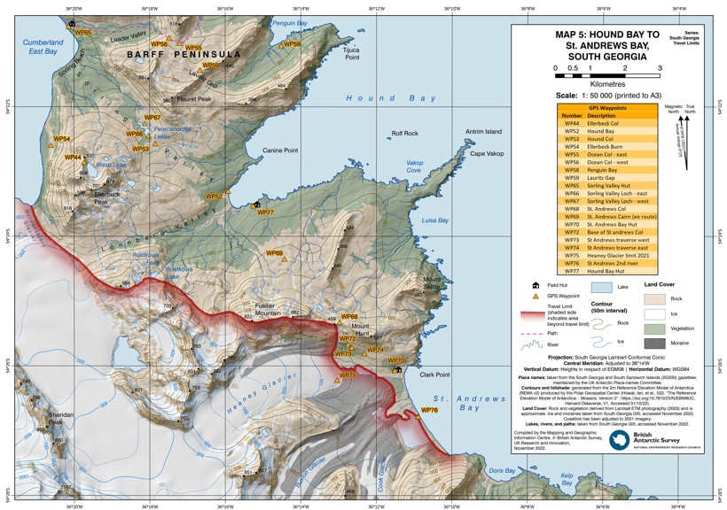
Map of St Andrews Bay, South Georgia. Includes contours, spot heights, land cover information and locations of paths, field huts and GPS waypoints.
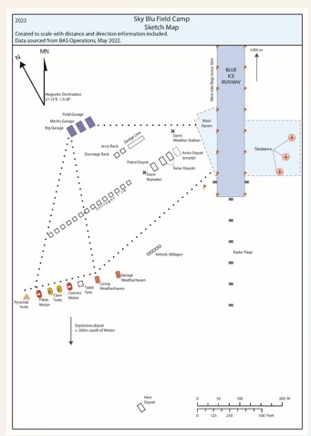
Site map of Sky Blu field camp produced for Standard Operating Procedure (SOP) documentation, showing locations of sites of interest and runway.
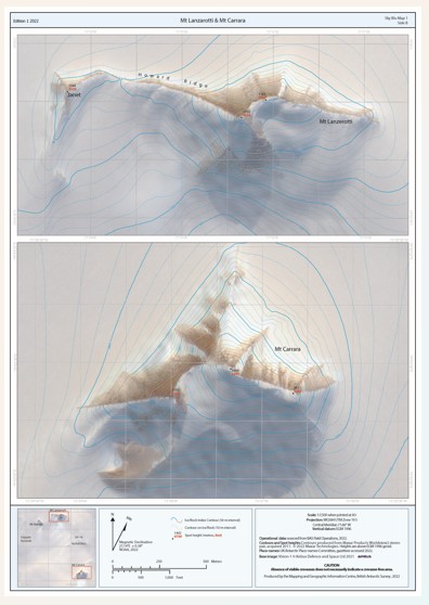
Topographic map of Sky Blu in two panels, showing Mt Lanzarotti and Mt Carrera local regions. Includes contours and spot heights.
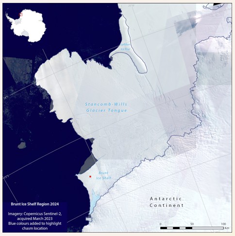
Map of wider Stancomb-Wills and Brunt Ice Shelf region, showing the location of Halley VIa and Chasm 2 as of March 2023.
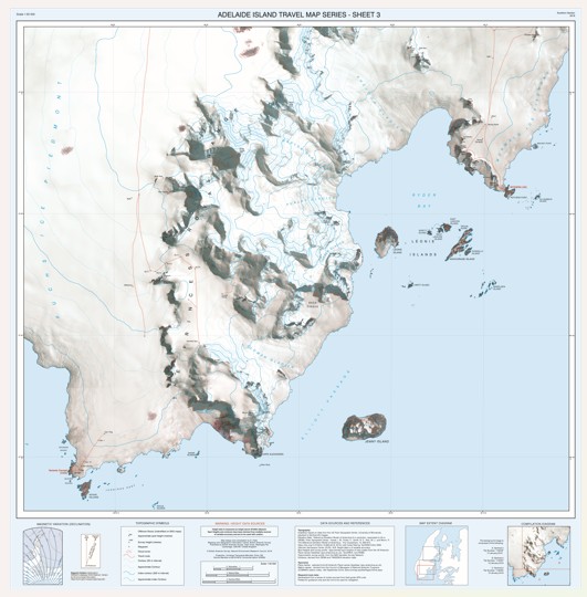
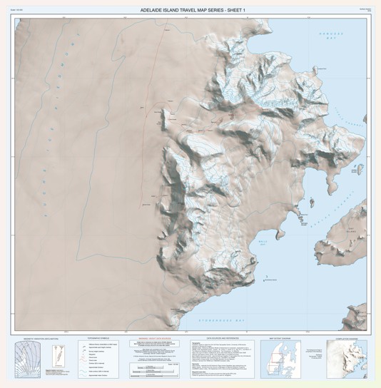
Topographic Map of Adelaide Island from Sheldon Glacier to southern Adelaide including Rothera Research Station, including satellite imagery, contours, spot heights, and operational data for Rothera winter trips.
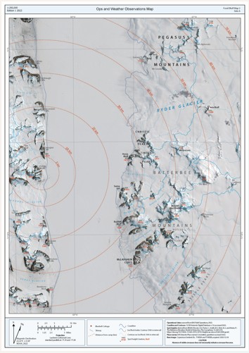
Topographic map of Fossil Bluff regional area with satellite imagery, showing distance radii from Fossil Bluff skiway for weather observations.
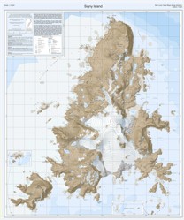
Topographic Map of Signy Island, showing contours, spot heights, locations of huts, and flagline.
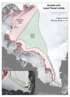
Topographic Map of Rothera local area, showing Technical and Local travel areas, flagline and Piston Bully-only route.
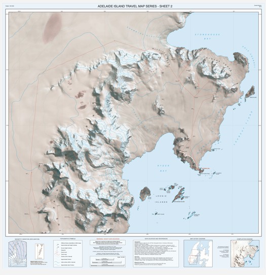
Topographic Map of Adelaide Island from Stonehouse Bay to Ryder Bay, including Rothera Research Station and the Princess Royal Range, including satellite imagery, contours, spot heights, and operational data for Rothera winter trips.
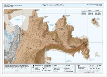
Topographic Map of Signy Island, showing contours, spot heights, locations of huts, routes and the unencumbered travel area.
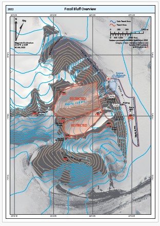
Overview map of Fossil Bluff local region produced for Standard Operating Procedure (SOP) documentation, showing locations of sites of interest, flagline, skiway, and travel areas.
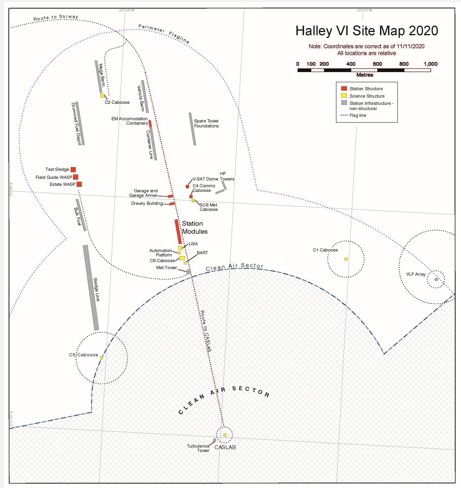
Map of Halley VIa Research Station, showing locations of station structures and infrastrure, and flagline perimeters. Data and locations correct as of 11/11/2020. All locations are relative.
Overview map of Sky Blu local region produced for Standard Operating Procedure (SOP) documentation, showing contours and spot heights, locations of sites of interest and runway.
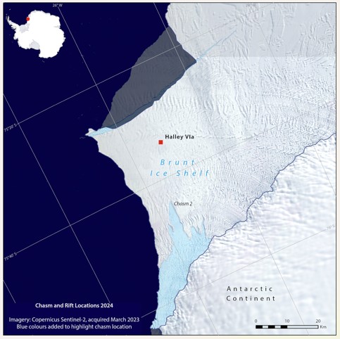
Map of Brunt Ice Shelf region, showing the location of Halley VIa and Chasm 2 as of March 2023.
Topographic Map of Adelaide Island from Hanusse Bay to Stonehouse Bay, including satellite imagery, contours, spot heights, and operational data for Rothera winter trips.
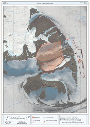
Topographic map of Fossil Bluff local area with satellite imagery, showing locations of sites of interest, flagline, skiway, and travel areas.
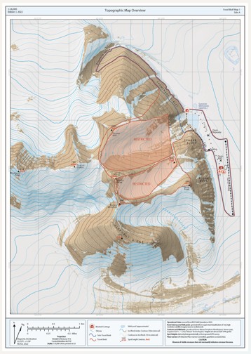
Topographic map of Fossil Bluff local area, showing locations of sites of interest, flagline, skiway, and travel areas.
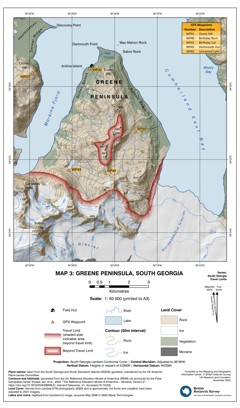
Map of Greene Peninsula, South Georgia. Includes contours, spot heights, land cover information and locations of paths, field huts and GPS waypoints.
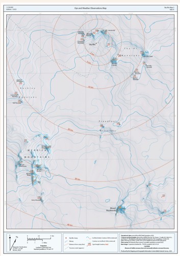
Topographic map of Sky Blu regional area with satellite imagery, showing distance radii from Sky Blu runway for weather observations.
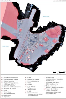
Map of Rothera Research Station, showing locations of instruments and and buildings as of December 2023. Projection: Rothera Local Grid.
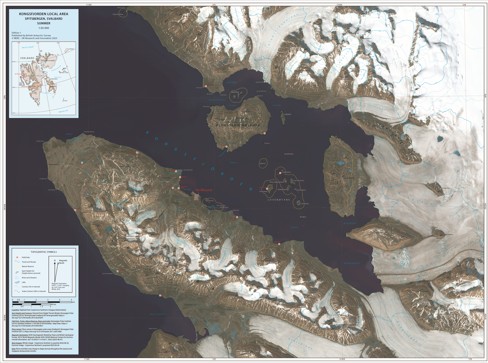
Map of Kongsfjorden local area, showing locations of huts, tracks and nature reserves as of June 2023, mapped over a satellite image from August 2025.
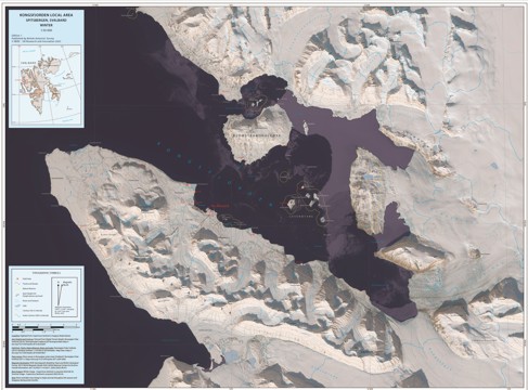
Map of Kongsfjorden local area, showing locations of huts, tracks and nature reserves as of June 2023, mapped over a satellite image from May 2025.
A collection of maps produced for BAS Air Unit activities by the Mapping and Geographic Information Centre, British Antarctic Survey.
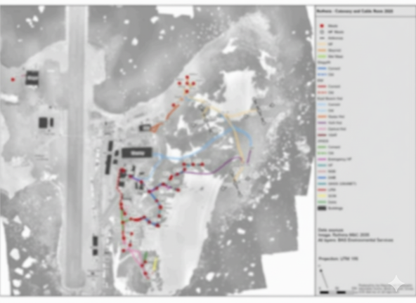
Site Map of Rothera Research Station showing locations of masts, catenaries and cable runs for 2025.
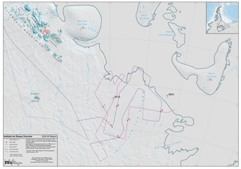
Topographic map of Institute Ice Stream region, showing instruments, planned traverse routes, and field camps for the IGIS project.
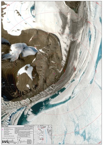
Topographic map of Mars Oasis region, showing the location of a previous field site with distance radii in 500 m intervals.
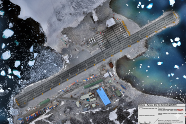
Rothera runway map with maintenance grid and surrounding area.
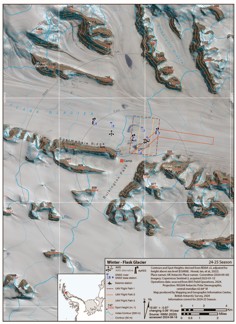
Map of Flask Glacier region 24/25 science season, showing planned study area and location of camp and instruments for use in operations planning during the 2025-26 operational season.
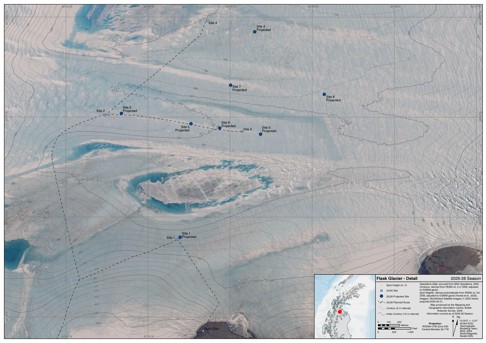
Map of Flask Glacier focussed on the study area for use in operations planning during the 2025-26 operational season.
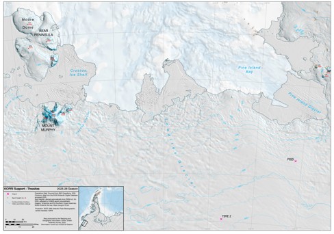
Map of Thwaites Glacier/Walgreen Coast region showing the location of previous field sites for use in operations planning during the 2025-26 operational season.
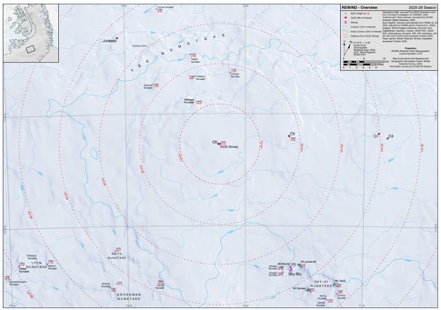
Map of Palmer Land region showing the location of REWIND study sites mapped over the Esri WorldImagery basemap. For use in operations planning during the 2025-26 operational season.
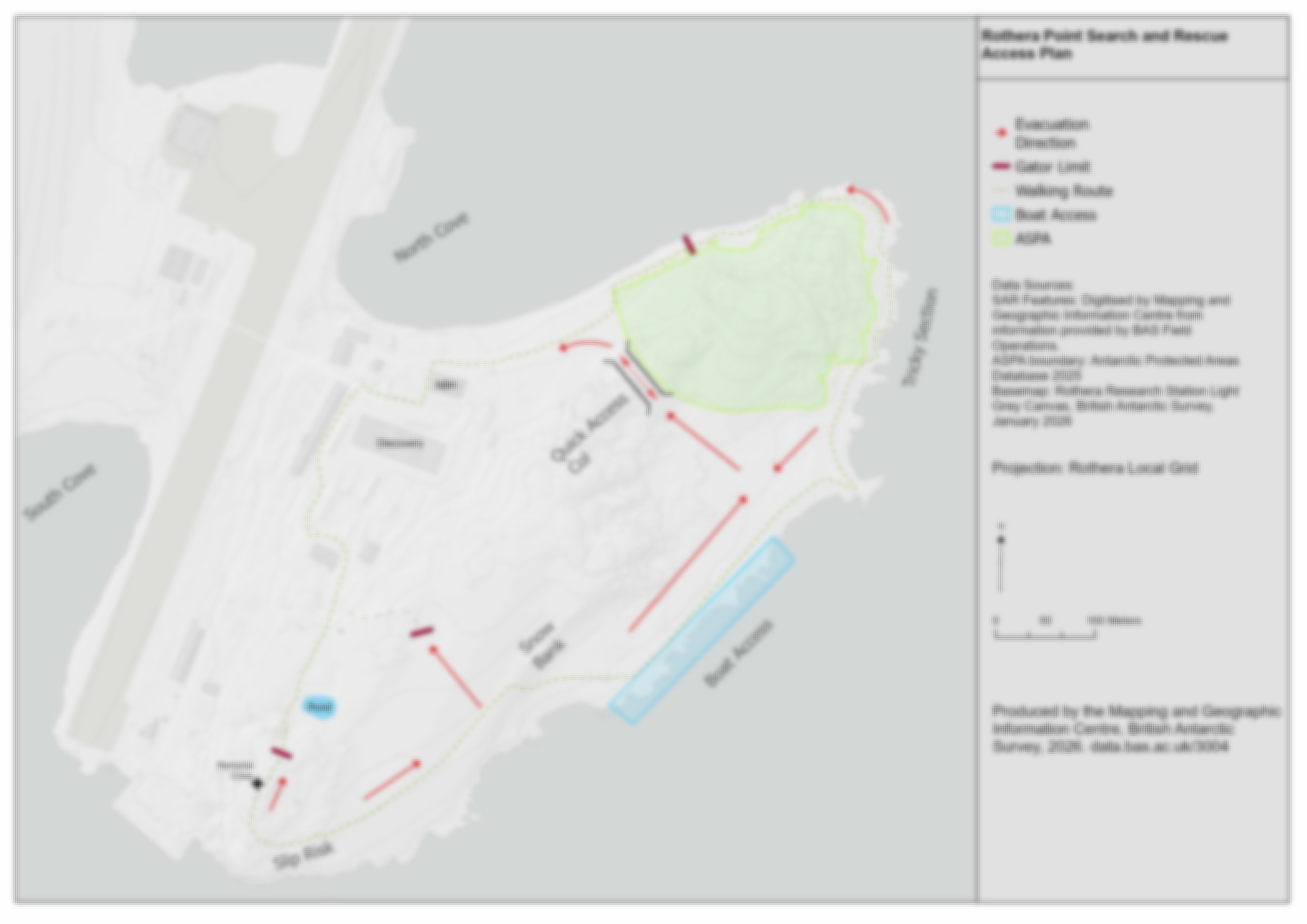
Search and Rescue Map for Rothera Point.
Bounding Coordinates
- South-West Corner (min x/y)
- South: -90.0, West: -180.0
- North-East Corner (max x/y)
- North: 79.0679465, East: 180.0
Part of these collections
The Mapping and Geographic Information Centre (MAGIC) provides geospatial information, expertise and services to BAS and wider UK activity in the polar regions.
A portfolio of maps produced by the Mapping and Geographic Information Centre, British Antarctic Survey.
Item Information
- Item ID
- ef7bc35e-7ad8-4ae5-9ae8-dd708d6e966e
- Item Type
- COLLECTION
- Item edition
- 24
- Item Created
- Item Published
- Item Updated
- Item Released
- Item Status
- Item is complete and recommended for general use
- Item Update Frequency
- Item may be updated if needed
Metadata Information
- Last updated
- Metadata Standard
- ISO 19115-2 Geographic Information - Metadata - Part 2: Extensions for Imagery and Gridded Data
- Metadata Standard Version
- ISO 19115-2:2009(E)
- Metadata Profiles
- British Antarctic Survey (BAS) Mapping and Geographic Information Centre (MAGIC) Discovery Metadata Profile (v2) External link, opens in a new window.
- British Antarctic Survey (BAS) Mapping and Geographic Information Centre (MAGIC) Administration Metadata Profile (v1) External link, opens in a new window.
- Metadata Licence
- Creative Commons Attribution-NoDerivatives 4.0 International External link, opens in a new window.
- Metadata Links
- Item page build time
Alternative contact methods
By post
British Antarctic SurveyHigh Cross
Madingley Road
Cambridge
Cambridgeshire
CB3 0ET
United Kingdom
By phone
By email
Privacy Notice
If you contact us, your personal information will be retained for up to three years and then deleted. It will only be used to contact you regarding your enquiry. If this item relates to an external organisation, we may share an anonymised version of your enquiry with them to help answer your query.
We use Cloudflare Turnstile, a third-party service, to protect against spam enquires.
See our privacy policy for more information.